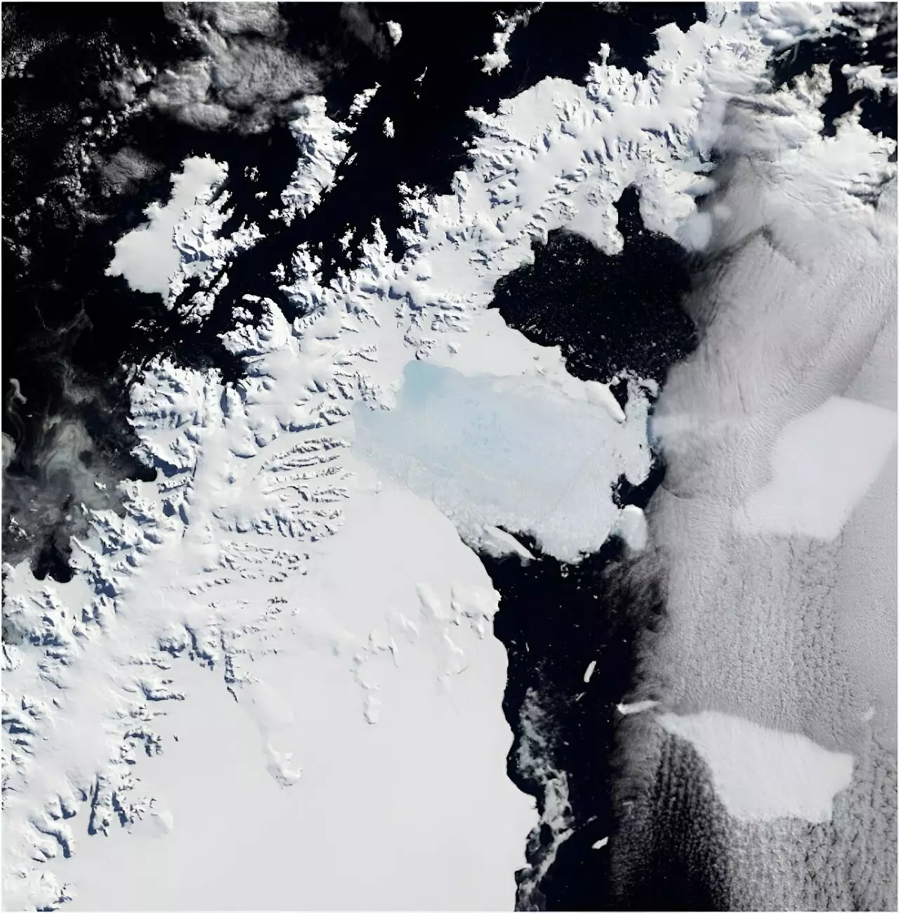
March 2002 marked a catastrophic point in climatic history when the Larsen B Ice Shelf collapsed, a disintegration that spanned an area roughly equivalent to one-sixth of Tasmania. This event was not merely an isolated incident; it set off a chain reaction affecting the glaciers that had once been sheltered by the ice shelf. Soon after, these glaciers began their rapid decline, contributing significantly to global sea-level rise. As citizens of a planet grappling with the dire consequences of climate change, one must question how events in such distant locales can impact us on a daily basis. The reality is stark: the melting of Antarctic ice shelves has the potential to reshape coastal communities and ecosystems worldwide, making it imperative to understand these changes through their historical context.
A Journey Through Time: Analyzing Historical Images
In a groundbreaking study recently published in *Scientific Reports*, researchers tapped into an astonishing collection of nearly 1,000 film photographs capturing Antarctica in the 1960s. Through this rigorous analysis, scientists reconstructed the state of five glaciers, revealing the extent of their transformations leading up to the ice shelf’s collapse. Historically, Antarctic observations have been few and far between, especially prior to 2002. Data collection is often hindered by the region’s extreme remoteness, making traditional monitoring prohibitively challenging. Yet, this treasure trove of images, taken between 1946 to 2000 by U.S. Navy cartographers, offers a valuable window into the region’s past conditions, enabling researchers to draw critical comparisons against present-day measurements.
The Underlying Mechanics of Ice Melting
Ice shelves, by their very nature, are floating extensions of glaciers that act as barriers against land-based ice. Their melting does not directly contribute to sea-level rise; rather, it is their removal that facilitates an accelerated flow of glaciers into the ocean. Prior to the collapse of Larsen B Ice Shelf, the glaciers remained relatively stable, but the elimination of the ice shelf precipitated their rapid decline. After 2002, scientists documented a staggering loss of 35 billion tons of land-based ice from these glaciers alone, with a particularly substantial contribution coming from one large glacier that shed 28 billion tons. To put this loss into perspective, the amount of water corresponding to that loss is equivalent to each person on Earth pouring out a one-liter water bottle every day for a decade—a startling and tangible reminder of the scale of environmental change we are confronting.
The Role of Technology in Data Collection
In this era of technological advancement, satellite imagery has become a favored method for monitoring climate changes in remote areas like Antarctica. However, persistent cloud cover often obscures the view, restricting data collection to short-term observations. This is where the historical photograph archive comes into play. The Polar Geospatial Center at the University of Minnesota has made these high-resolution images accessible, offering a comparable resolution to contemporary satellite imagery. Researchers employed photogrammetry—a technique that calculates the three-dimensional coordinates of points based on overlapping photographs—to create accurate models of the glaciers. By leveraging technology, we can recreate detailed representations of glaciers, enhancing our understanding of how they have changed over time.
Broader Implications and Future Directions
Although the current focus lies on how glaciers reacted to the collapse of the Larsen B Ice Shelf, the implications of this research extend far beyond. The historical image archive can be used to explore a myriad of topics, including the dynamics of other ice shelves, coastal changes, wildlife populations such as penguin colonies, the encroachment of flora, and even the impacts of human activity. As the climate crisis accelerates, a deeper investigation into these changes is not just beneficial; it is essential for crafting a comprehensive understanding of our planet’s shifting landscape.
By engaging with these archival records today, we can equip ourselves with the knowledge necessary to anticipate future shifts and mitigate their consequences. This proactive approach is vital to ensuring that we do not merely react to these changes, but also take informed steps toward sustainability and environmental stewardship. The significance of these historical records cannot be understated; they offer a profound opportunity to learn from the past in order to safeguard our shared future on this fragile planet.
Leave a Reply