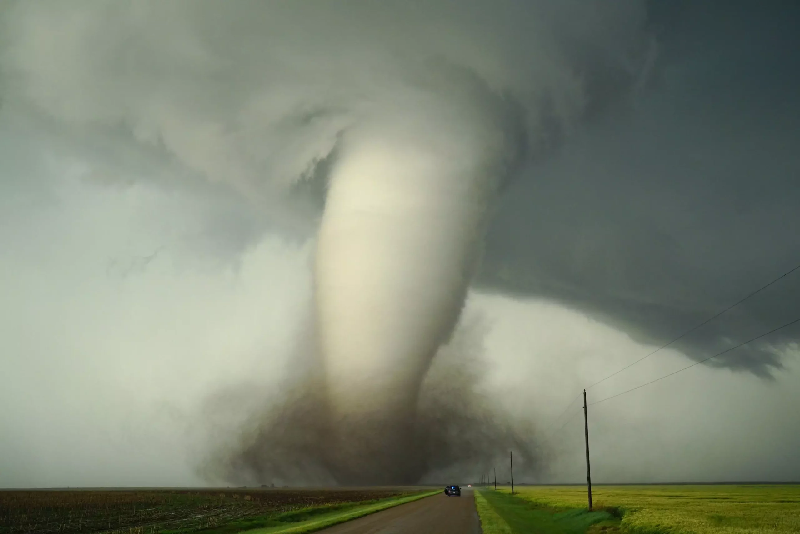
Tornadoes are among the most awe-inspiring yet destructive phenomena in nature, capable of devastating entire communities within moments. While their ferocity commands respect, understanding the underpinnings of what causes tornadoes remains an ongoing scientific challenge. At the forefront of this pursuit is a critical examination of how Earth’s climate systems and land configurations influence these violent storms. Contrary to popular belief that tornadoes are capricious acts of nature, emerging research emphasizes that they are intricately tied to large-scale environmental patterns shaped over centuries. Recognizing the precise role of climate and geography in setting the stage for tornado development shifts the narrative from mere chance to a complex interplay that can potentially be understood—and perhaps mitigated.
This perspective is not just academic jargon; it’s a clarion call for scientific curiosity that seeks to demystify tornado pathways. It prompts us to reevaluate assumptions held for decades, such as the significance of the Gulf of Mexico or the Rocky Mountains in fostering severe weather. Rather than seeing tornadoes as isolated events, they should be viewed as outcomes dependent on the broader environmental canvas. When we realize that regional landforms and climate influences are fundamental to where and when tornadoes emerge, we open pathways to improved prediction, preparedness, and possibly, future climate-based interventions.
The Power of Virtual Experiments in Climate Science
Advances in computational modeling have revolutionized how scientists approach meteorological mysteries. Instead of relying solely on observational data—which, while rich, is often limited in scope—researchers like Dan Chavas leverage sophisticated climate simulations to conduct “what-if” analyses. These virtual experiments allow scientists to manipulate Earth’s features—flattening mountain ranges or filling in oceanic bodies—and observe resulting shifts in storm behavior. Such experiments move beyond hypotheses, providing concrete insights into causality.
For example, Chavas’ team examined the longstanding hypothesis that the Gulf of Mexico’s warm, moist air is a chief driver of North American tornadoes. By virtually replacing the Gulf with land, they discovered that while the overall number of severe storms slightly declined, the geographical distribution of storms shifted eastward. This indicates that regional land features influence storm paths more subtly than previously thought, impacting not just the frequency but also the intensity and locations vulnerable to tornadoes.
Similarly, by altering the Earth’s surface roughness in different regions, researchers uncovered crucial links between topography, wind shear, and tornado likelihood. These findings challenge simplistic notions that warm oceans alone dictate storm development, emphasizing the need for a multidimensional understanding that considers physical land features, atmospheric conditions, and climate dynamics in concert.
The Geography of Tornadoes: Land Surface, Wind Shear, and Weather Patterns
One of the most compelling discoveries from recent research is how Earth’s land surface—its roughness, vegetation, and topography—moderates the atmospheric ingredients essential for tornado formation. Wind shear, which is the variation in wind speed and direction with height, stands out as a critical factor. A smoother surface like the Gulf of Mexico allows sustained wind shear and high moisture levels to coexist, fostering an environment ripe for tornadoes. In contrast, rougher land surfaces—such as dense forests or mountainous terrains—disrupt wind patterns near the surface, reducing wind shear and thus the likelihood of tornado genesis.
This insight redefines the landscape’s role in severe weather risk, suggesting that land cover changes—either through natural growth or human activity—could influence tornado patterns over time. The Amazon rainforest, with its dense canopy and rugged terrain, appears to mitigate tornado formation over parts of South America by disrupting wind shear. Conversely, the relatively smooth and flat terrain east of the Rocky Mountains in North America facilitates the creation of the classic tornado alley, where the right ingredients—warm moist air, wind shear, and instability—combine to produce frequent and often devastating tornadoes.
This understanding should galvanize efforts toward landscape management as a tool for climate adaptation. If reforestation or land use planning can modify surface roughness and wind flows, then perhaps future generations might influence local weather patterns to reduce tornado risks. Such interventions, however, require careful consideration of ecological and societal factors, emphasizing that climate and land are dynamic partners in shaping weather—and not just passive backdrops.
The Influence of Climate Change on Future Tornado Risks
As climate change continues to reshape global weather systems, it’s imperative to analyze how these shifts might influence tornado frequency and intensity. Rising temperatures and changing precipitation patterns are already known to alter the atmosphere’s energy and moisture content, but the impact on wind shear and land surface conditions remains less clear. Emerging evidence suggests that shifts in jet streams, altered wind patterns, and land surface modifications—whether through urbanization, deforestation, or agricultural development—can significantly influence regional storm dynamics.
For instance, if the jet stream becomes more variable, areas that previously rarely experienced tornadoes might become susceptible, while traditional hotspots could see decreases. The potential regrowth of forests in tornado-prone regions, or conversely, widespread deforestation, could modify wind shear profiles essential for storm rotation. Thus, human-driven land use changes, combined with climate dynamics, could either exacerbate or mitigate severe weather threats, depending on how they influence atmospheric ingredients.
A major takeaway is that addressing future tornado risks necessitates a comprehensive approach that couples climate mitigation with land management strategies. Understanding these interconnected factors might provide a crucial window of opportunity—not just to predict, but to influence—the future landscape of severe storms. Failing to incorporate land and climate interactions into our models leaves us vulnerable to underestimating or misjudging tornado risks in a changing world.
—
The Road Ahead: Harnessing Knowledge for Resilient Communities
While science advances rapidly, translating these insights into tangible safety measures remains a challenge. The notion that we might influence future storm patterns through land management or climate policy is provocative but requires cautious optimism. Still, recognizing the profound influence of Earth’s physical features on tornado formation empowers communities and policymakers alike to consider more holistic strategies for hazard mitigation.
In an era where weather extremes are becoming more pronounced, understanding the underlying mechanisms that govern tornado genesis provides not just scientific enlightenment but actionable intelligence. A future where we can predict, and possibly reduce, the destructive capacity of tornadoes hinges on our ability to decode and manipulate the complex interplay between climate, land, and atmospheric dynamics—an endeavor that demands relentless curiosity, technological innovation, and ecological foresight.
Leave a Reply